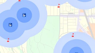
Are you ready to explore the world of Geographic Information Systems (GIS) and learn how to transform and visualize data? Join us in this beginner-friendly guided project where working with urban parks data and master the essential function of table joins in GIS.


您将学到什么
Familiarize yourself with the ArcOnline environment and become comfortable with importing new layers and analyzing table data.
Understand how to perform basic aerial analyses and change the map symbology. Learn how to make a user-friendly map for potential clients.
Apply the cumulative geospatial information into a tool for non-technical users. Become proficient in amplifying your map's information density.
您将练习的技能
要了解的详细信息

添加到您的领英档案
仅桌面可用
了解顶级公司的员工如何掌握热门技能

在不到 2 个小时的时间内学习、练习和应用为就业做好准备的技能
- 接受行业专家的培训
- 获得解决实训工作任务的实践经验
- 使用最新的工具和技术来建立信心

关于此指导项目
分步进行学习
在与您的工作区一起在分屏中播放的视频中,您的授课教师将指导您完成每个步骤:
By the end of Task 1, you'll be able to navigate databases and understand how to find, export, and import geospatial data.
By the end of Task 2, you'll be able to use ArcGIS Online to perform aerial analyses from satellite data while navigating table data.
By the end of Task 3, you'll have the skills to change pop-ups and edit data to fit your specific needs.
By the end of the practice task, you'll be proficient in utilizing government databases to import new layers and analyze table data within the ArcGIS Online environment.
By the end of Task 4, you'll know how to perform table joins in ArcGIS. You will understand the importance of joins the power of geospatial tools by transforming table data into a visualization.
By the end of Task 5, you'll be able to finalize and share the map with an organization and expand your publishing capabilities.
By the end of the cumulative task, you'll have applied all the skills acquired to create a functional, user-friendly map.
推荐体验
1. Basic understanding of the definition of GIS
2. Knowledge of basic map elements like legends, symbols, and icons
3. ArcGIS Online Account
3个项目图片
位教师

学习方式
基于技能的实践学习
通过完成与工作相关的任务来练习新技能。
专家指导
使用独特的并排界面,按照预先录制的专家视频操作。
无需下载或安装
在预配置的云工作空间中访问所需的工具和资源。
仅在台式计算机上可用
此指导项目专为具有可靠互联网连接的笔记本电脑或台式计算机而设计,而不是移动设备。
人们为什么选择 Coursera 来帮助自己实现职业发展


学生评论
10 条评论
- 5 stars
60%
- 4 stars
30%
- 3 stars
0%
- 2 stars
0%
- 1 star
10%
显示 3/10 个
已于 Aug 29, 2024审阅
excellent intro to ArcGis and doing something useful very quickly
您可能还喜欢
 状态:免费试用
University of Michigan
 状态:免费试用
University of Toronto
 状态:预览
状态:预览Coursera Instructor Network
常见问题
购买指导项目后,您将获得完成指导项目所需的一切,包括通过 Web 浏览器访问云桌面工作空间,工作空间中包含您需要了解的文件和软件,以及特定领域的专家提供的分步视频说明。
由于您的工作空间包含适合笔记本电脑或台式计算机使用的云桌面,因此指导项目不在移动设备上提供。
指导项目授课教师是特定领域的专家,他们在项目的技能、工具或领域方面经验丰富,并且热衷于分享自己的知识以影响全球数百万的学生。

 中
中


