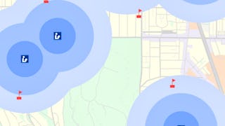
The world is currently experiencing complex challenges in social, economic, and environmental sustainability. Geographic information systems (GIS) help us organize, analyze, and display large spatial datasets that reveal critical spatial and temporal patterns crucial for addressing these complex issues.


您将学到什么
Learn how GIS are used for solving complex environmental and sustainability problems
Analyze spatial data to visualize and assess sustainability issues
Learn to engage stakeholders using geospatial visualizations
Gain insight on the importance of GIS for environmental decision-making
您将获得的技能
要了解的详细信息

添加到您的领英档案
4 项作业
了解顶级公司的员工如何掌握热门技能

积累特定领域的专业知识
- 向行业专家学习新概念
- 获得对主题或工具的基础理解
- 通过实践项目培养工作相关技能
- 获得可共享的职业证书

该课程共有4个模块
Welcome to Module 1. This module introduces the course, including the instructors and the layout of the course. You will learn what GIS is and how GIS can be used to monitor, identify, and assess sustainability issues. You will hear about the relevance of GIS to environmental sustainability efforts from guest interviewees. Through a demonstration video, you will be exposed to some leading GIS software applications. The Skill Building Exercises focus on orienting you to basic map functionality and discerning spatial patterns in real-world datasets.
涵盖的内容
5个视频11篇阅读材料1个作业1个应用程序项目2个讨论话题
In Module 2, you will explore how GIS is used to identify trends and perform forecasting related to issues of sustainability. You will hear from two GIS professionals about the intersection of GIS and sustainability in their work. And you will learn about map design best practices, especially regarding which data to use and how to present data in ways that highlight patterns or trends. In the Skill Building Exercises, you will hone skills built in the previous module, gain proficiency with near real-time datasets, and analyze spatiotemporal trends through data filters.
涵盖的内容
3个视频3篇阅读材料1个作业1个应用程序项目1个讨论话题
Module 3 introduces the utility of GIS to optimize planning and decision-making, implement sustainable solutions, and enhance community awareness. You will learn how different types of thematic maps can help visualize geographic data. You will hear from GIS professionals about the importance of GIS to their environmental sustainability research. In the Skill Building Exercise you will develop skills in multi-criteria analysis and suitability mapping using overlay analyses.
涵盖的内容
2个视频3篇阅读材料1个作业1个应用程序项目1个讨论话题
Module 4 emphasizes the utility of GIS to engage stakeholders, empower communities, and create compelling narratives. You will hear from sustainable leadership and GIS professionals about the relevance and future of GIS in sustainability engagement. You will learn about different map use environments. The Skill Building Exercises focus on how digital storytelling combined with spatial analyses through story maps can increase accessibility of complex sustainability issues.
涵盖的内容
4个视频4篇阅读材料1个作业1个应用程序项目1个讨论话题
获得职业证书
将此证书添加到您的 LinkedIn 个人资料、简历或履历中。在社交媒体和绩效考核中分享。
从 Data Analysis 浏览更多内容
 状态:免费试用
University of California, Davis
 状态:预览
状态:预览Coursera Instructor Network
 状态:免费试用
University of Michigan
 状态:免费试用
University of Toronto
人们为什么选择 Coursera 来帮助自己实现职业发展


学生评论
10 条评论
- 5 stars
80%
- 4 stars
10%
- 3 stars
0%
- 2 stars
10%
- 1 star
0%
显示 3/10 个
已于 Aug 9, 2025审阅
Amazing course with insightful interviews. highly recommended
常见问题
To access the course materials, assignments and to earn a Certificate, you will need to purchase the Certificate experience when you enroll in a course. You can try a Free Trial instead, or apply for Financial Aid. The course may offer 'Full Course, No Certificate' instead. This option lets you see all course materials, submit required assessments, and get a final grade. This also means that you will not be able to purchase a Certificate experience.
When you enroll in the course, you get access to all of the courses in the Specialization, and you earn a certificate when you complete the work. Your electronic Certificate will be added to your Accomplishments page - from there, you can print your Certificate or add it to your LinkedIn profile.
Yes. In select learning programs, you can apply for financial aid or a scholarship if you can’t afford the enrollment fee. If fin aid or scholarship is available for your learning program selection, you’ll find a link to apply on the description page.
更多问题
提供助学金,


 中
中

